The system is on track for Sunday, Dec. 11, according to the National Weather Service.
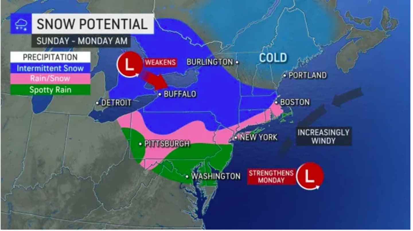
For a look at areas where a mix of rain and snow is possible (shown in pink) and areas where there could be intermittent snow (in blue), see the image above from AccuWeather.com.
The storm "could bring a couple of inches of snow to parts of upstate New York and northern Pennsylvania," AccuWeather Senior Meteorologist Joe Lundberg said.
The days leading up to the system's arrival will be dry with a mix of sun and clouds Thursday, Dec. 8, Friday, Dec. 9, and Saturday, Dec. 10 with a high temperature in the low to mid 40s to around 50 degrees each day, the National Weather Service says.
The storm is expected to arrive in the form of rainfall after midday Sunday, with the high temperature in the low 40s.
A wintry mix and snow are possible in areas where the temperature drops at or below the freezing mark after nightfall Sunday.
There is still uncertainty surrounding the precise timing, track, and strength of the storm.
Check back to Daily Voice for updates.
Click here to follow Daily Voice Harrison and receive free news updates.