Snowfall is possible at times on Long Island from Monday morning, Jan. 3 to early in the evening on Monday.
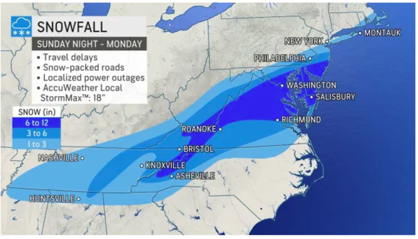
A Winter Weather Advisory is in effect for Suffolk County from 9 a.m. to 7 p.m. Monday, with up to 2 to 4 inches of accumulation possible, especially on the East End, according to the National Weather Service.
Between 1 and 2 inches of accumulation is expected for most of Nassau County.
Between 6 to 12 inches of accumulation is possible from Richmond, Virginia, and surrounding areas to Washington, DC. (See the first image above.)
"It may be hard to believe that any snow is on the way, given the warmth and lack of wintry weather thus far this season," AccuWeather Meteorologist Ryan Adamson said.
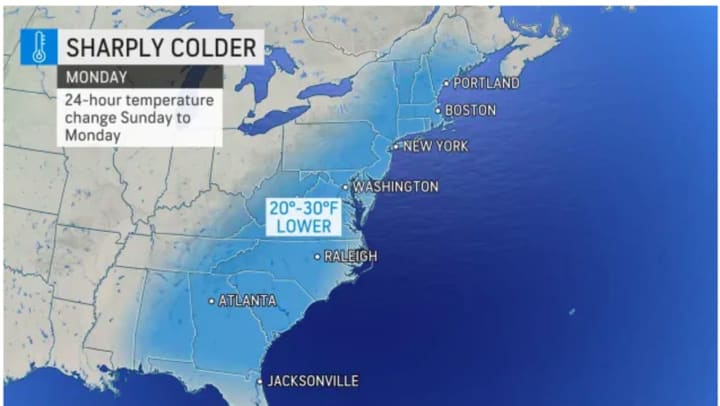
After the storm pushes through, skies will become clear late Monday night. The high temperature will struggle to pass the 30-degree mark and wind-chill values between 15 and 20 degrees.
Tuesday, Jan. 4 will be sunny with a high in the low to mid 30s.
Check back to Daily Voice for updates.
Click here to follow Daily Voice Nassau and receive free news updates.